
- TOP >
- Museum >
- Exhibition >
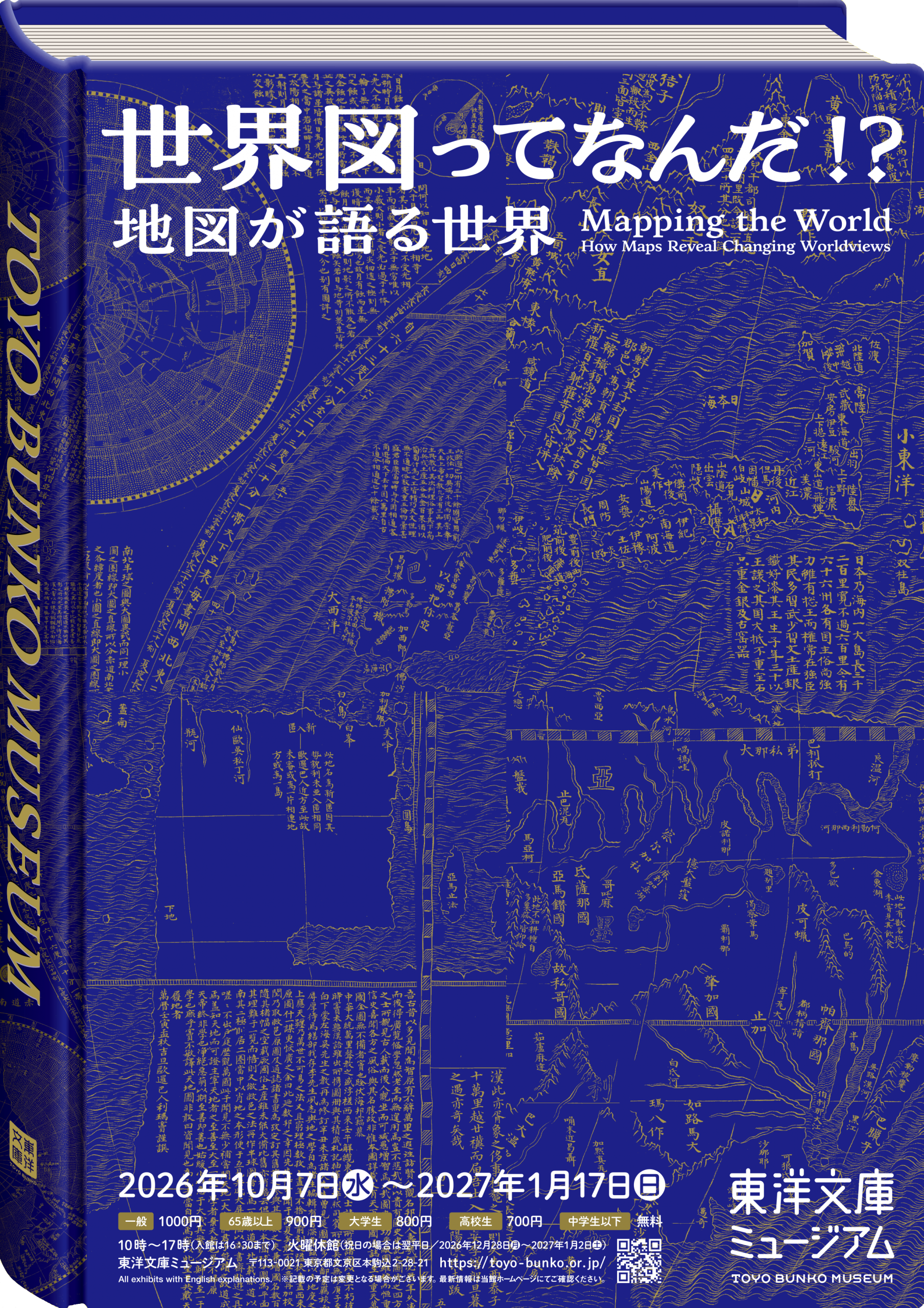
- Mapping the World: How Maps Reveal Changing Worldview
Mapping the World: How Maps Reveal Changing Worldview
2026.10.7 Wed -
2027.1.17 Sun
We live in an era when the world feels closer than ever, yet differences between nations and cultures are once again coming sharply into focus. At a time like this, why not return to a fundamental question: How did people in the past imagine the world and seek to understand the unknown?
At the heart of this exhibition is the Kunyu Wanguo Quantu (Complete Map of the Myriad Countries of the World), created in the early 17th century through the fusion of Western knowledge and a Chinese worldview. Following extensive restoration, the map is being exhibited at the Toyo Bunko Museum for the first time. With this remarkable work as its centerpiece, the exhibition traces the evolution of world maps in the West, China, and Japan, revealing the different ways each region has understood and engaged with the world.
We hope that the worlds depicted in maps of the past will invite us to reflect anew on how we see the world today.
The original titles and invoice numbers of the exhibited materials can be found here.
After the exhibition, these materials can be viewed in the reading room (some may not be available).
Please click here for detailed information on how to browse.
Exhibition Structure and Highlights
World Maps Prior to the Kunyu Wanguo Quantu: Eastern and Western Worldviews, Geography of Imagination and Hearsay
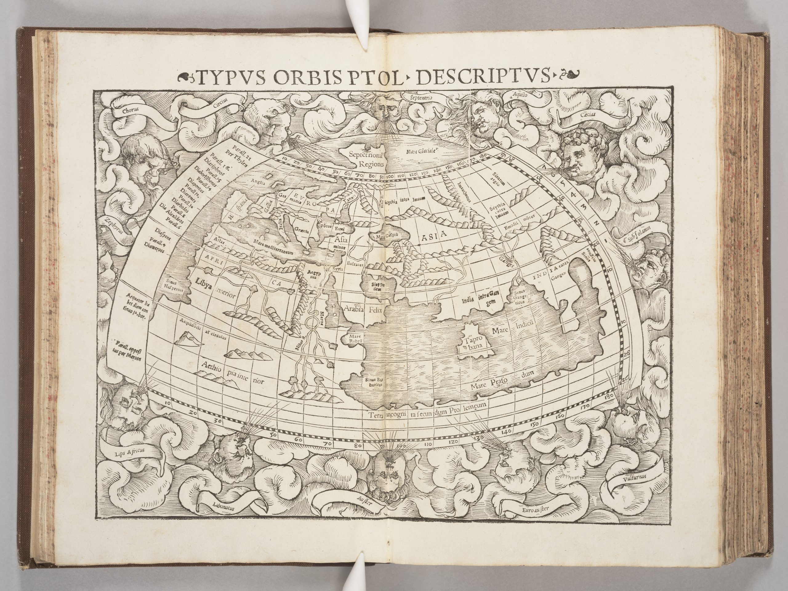
Geographia Universalis (General Geography), edited by Sebastian Münster, 1545, Basle (Swiss)
The “world map” on display is a 15th-century reconstruction based on Ptolemy’s Geography, written around 150 CE and regarded as the earliest work of mathematical geography. Although called a “world map,” it depicts only part of Eurasia, revealing how the “world” was understood at the time. After the publication of this book, Ptolemy’s Geography shifted from being regarded as an authoritative and accurate ancient geographical work to one valued for its historical importance. Geographical knowledge increasingly came to depend not on ancient texts, but on the latest observations and mapmaking based on them.
The Birth of Kunyu Wanguo Quantu (Complete Map of the Myriad Countries of the World)
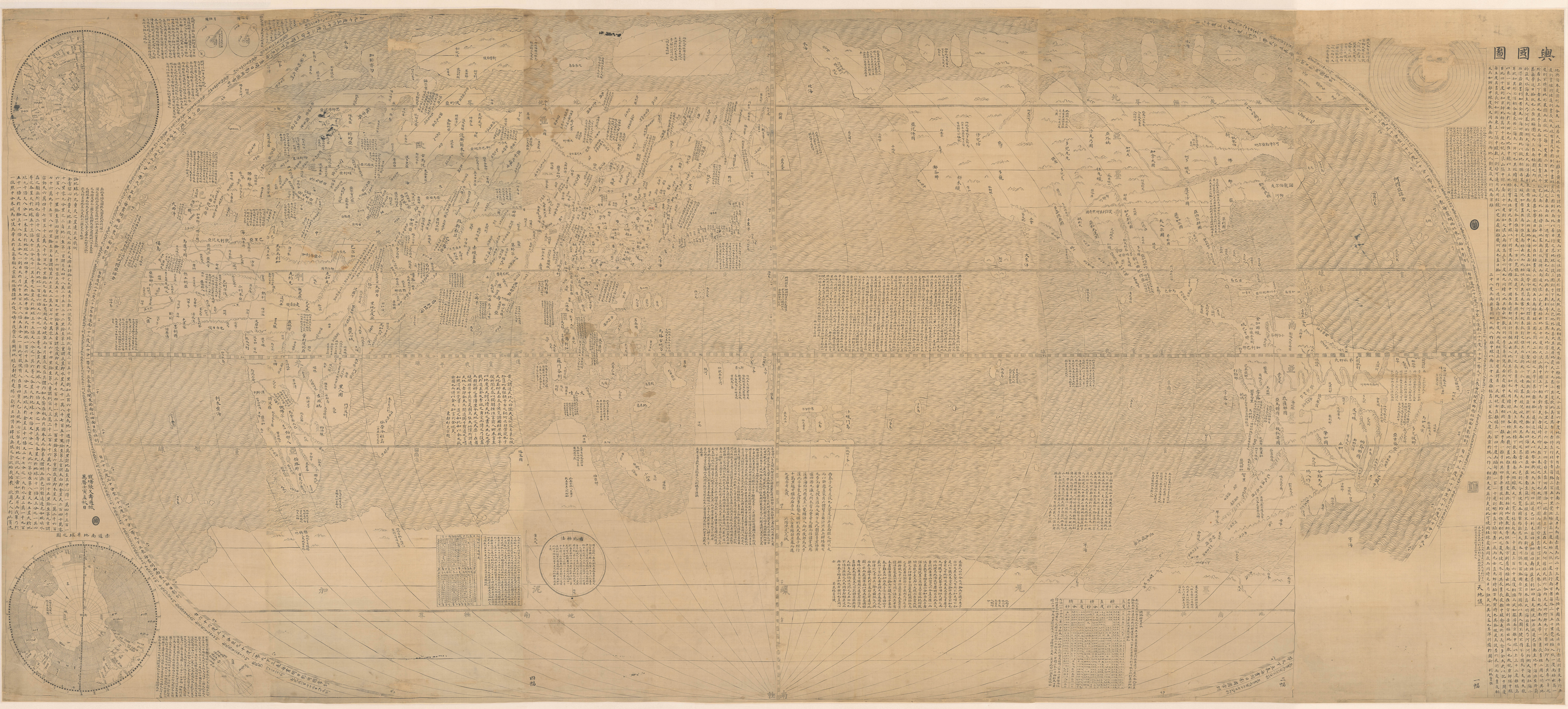
Kunyu Wanguo Quantu (Complete Map of the Myriad Countries of the World), Matteo Ricci, 17th–18th century (Qing dynasty), manuscript map
During the nearly thirty years between his arrival in Macau in 1582 and his death in Beijing in 1610, the Jesuit missionary Matteo Ricci produced several world maps. Among them was Kunyu Wanguo Quantu, published in Beijing during the Ming dynasty in 1602. The term kunyu, derived from the Yijing (Book of Changes), a Confucian classic, means “the earth as a vehicle.” Li Zhizao, a Ming official who later converted to Christianity, assisted in the map’s publication. Ricci’s preface appears intended to demonstrate the high level of European scholarship, and it is thought that this was part of an effort to advance missionary work.
The map itself was based on world maps then prevalent in Europe, including those of Ortelius, but was reconfigured to make it more readily acceptable to a Chinese audience: its text was written in Classical Chinese, and the Pacific Ocean was placed at the center. This was the first attempt to create a world map with such a layout. In addition to the continents and oceans projected in an oval (egg-like) shape, the margins contain detailed astronomical diagrams, descriptions of the world’s geography and peoples, and explanations of the methods used to create the map, all written in Classical Chinese. Conservative ministers at the Ming court fiercely criticized the finished map, claiming that it “exaggerated the outer barbarians (the world outside China)” and was “a fabrication plagiarized from ancient Chinese texts.” The Wanli Emperor himself, however, is said to have been pleased with it.
As for its transmission to Japan, it is presumed that Ricci sent the map to Jesuits stationed there. Since surviving Japanese manuscript copies are thought to have been copied from the first edition, the map is believed to have reached Japan relatively soon after its publication.
The Reception and Evolution of the Kunyu Wanguo Quantu in Japan
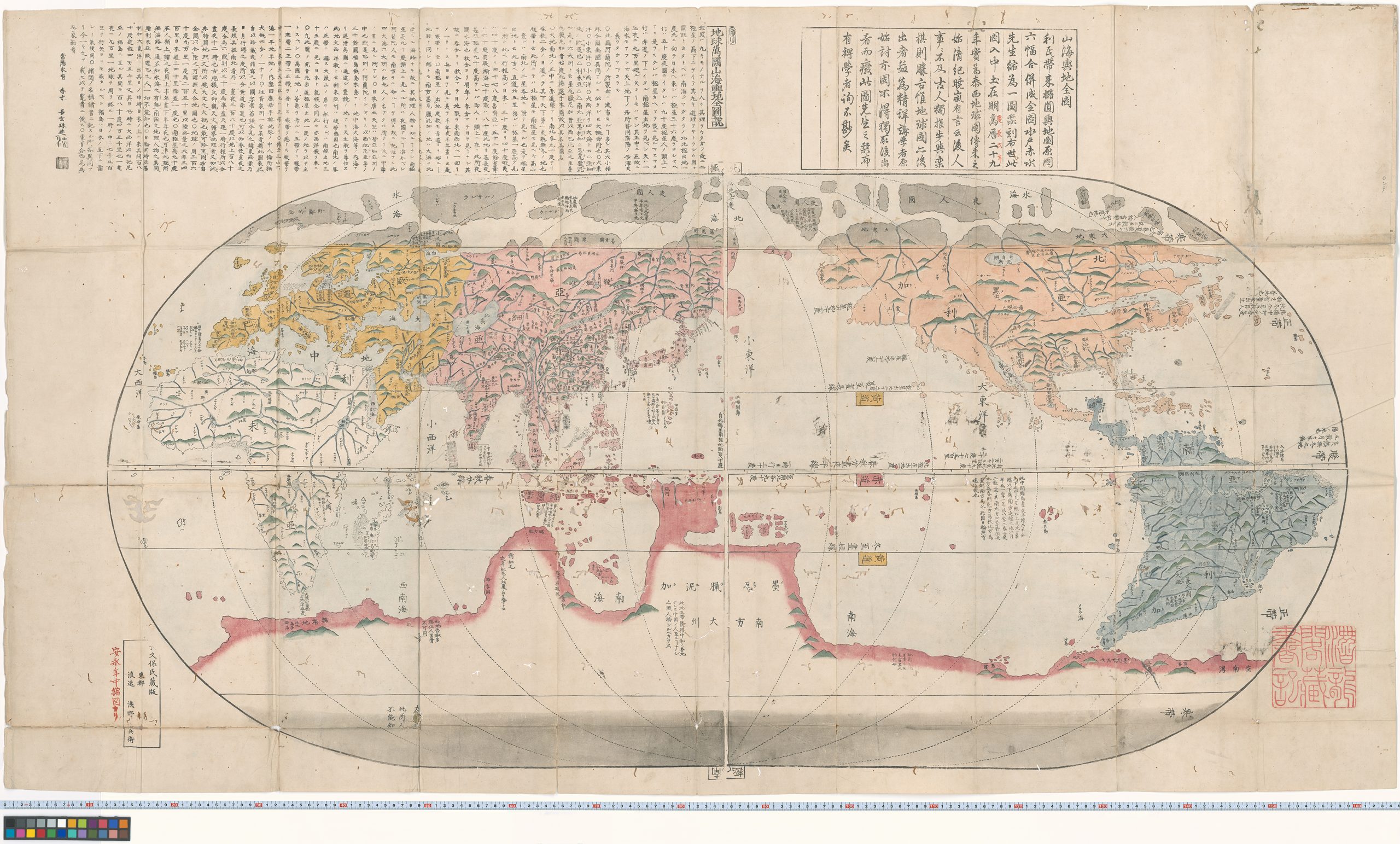
A Bestselling World Map by a Bestselling Mapmaker, Nagakubo Sekisui, probably c. 1785
Nagakubo Sekisui (1717–1801) was an Edo-period geographer who published the first map of Japan to include lines of latitude and longitude. Rising from a farming background to become a jikō (scholar-tutor to the lord) of the Mito Domain, he published maps of Japan, China, and the world, all of which became major hits. This world map belongs to the tradition of Matteo Ricci’s Kunyu Wanguo Quantu. In the accompanying commentary, Sekisui explains that he “pieced together and reduced” Ricci’s map and disseminated it through woodblock printing. The map contributed greatly to the spread of Ricci-style world maps and remained popular with the general public until the end of the Edo period, inspiring some fifty revised editions and imitations.
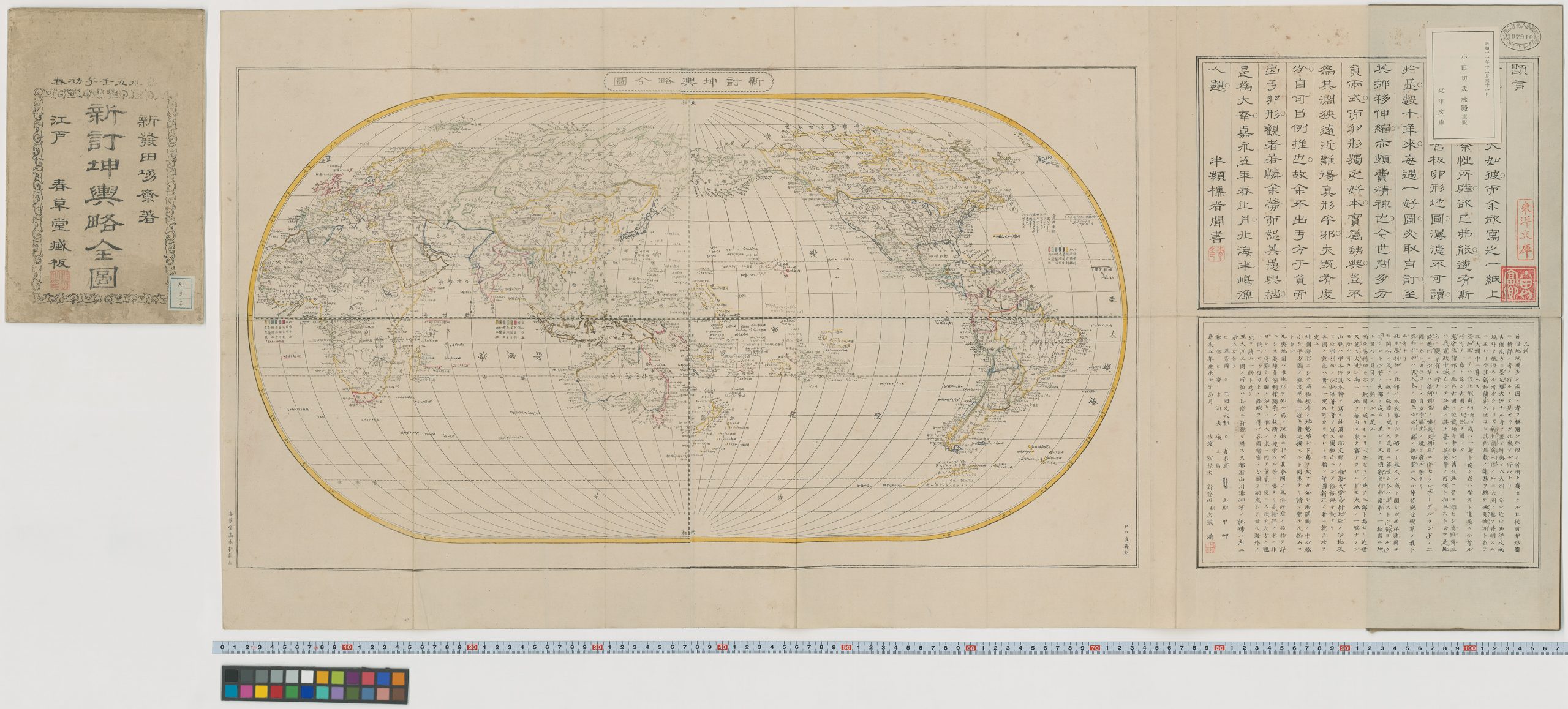
Newly Revised Oval Map of the World, Shibata Shūzō,1825
By the mid-nineteenth century, two-hemisphere world maps had largely replaced the older oval form associated with Matteo Ricci. Shibata Shūzō deliberately revived that format in his 1852 map, while incorporating the latest geographical knowledge available to him. The changing outlines and place names of Oceania are among the clearest signs that this was no mere reproduction of an older world map. An old cartographic form had been filled with a newly expanding world.
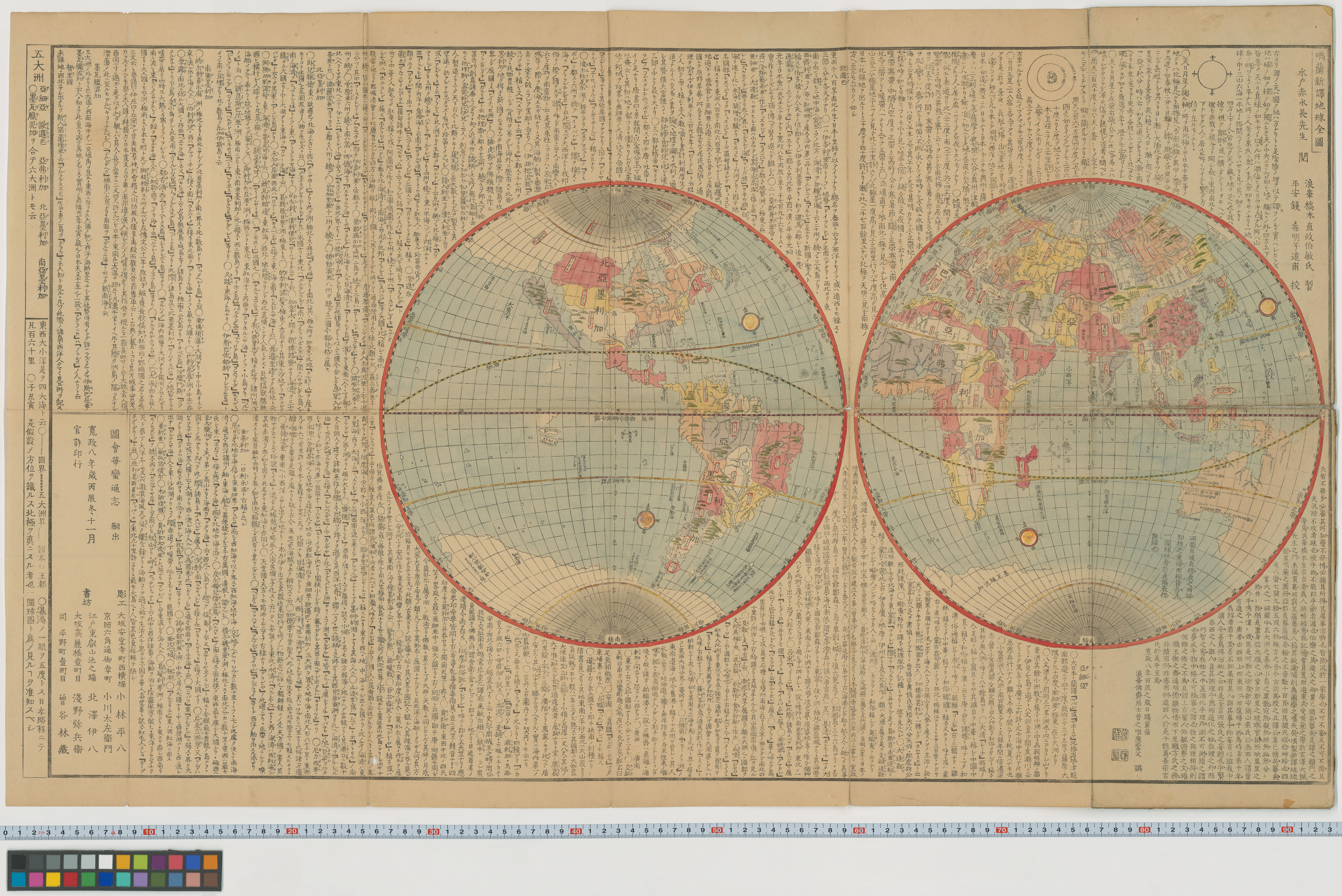
Two-Hemisphere World Map Based on Dutch Cartography, Hashimoto Sōkichi, 1796
In the late 18th century, two-hemisphere world maps appear to have been widely available for purchase in Edo, Japan. Hashimoto, this map’s creator, was a pioneer of Rangaku (Dutch studies) in Osaka. It depicts California as an island-a feature also found in Blaeu’s Atlas Major-as well as the southern continent of “Magellanica,” which by then was increasingly disappearing from maps. Since California is shown here as an island, rather than as the peninsula depicted on Shiba Kōkan’s map, Hashimoto is thought to have consulted an older Dutch map than Kōkan did.
China and Korea’s Return to Tradition and the Evolution of Western World Maps
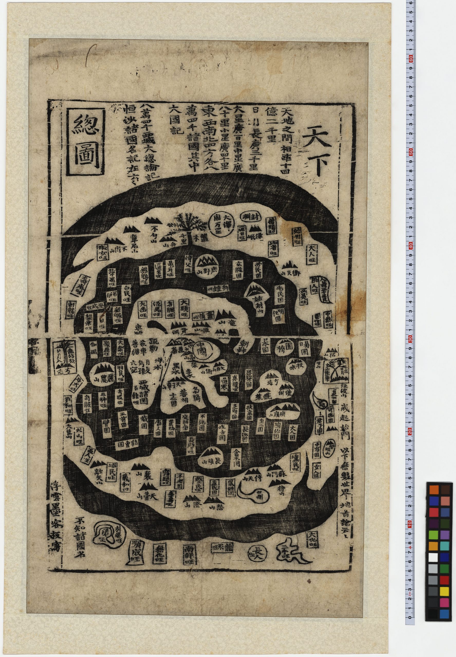
Cheonhado (Map of the World Beneath the Heavens), c. 18th – 19th century (Joseon dynasty of Korea)
This world map is included in an atlas containing maps of China, Korea, and Japan. While its circular composition reflects Western cartographic influence, the central landmass depicts actual geographical locations, such as China, alongside numerous places from legend. Although Western maps and geographical information were flowing into Korea during the 17th century, the Cheonhado—a map type uniquely developed to reflect traditional Korean thought, seemingly counter to prevailing trends—was widely produced in printed and manuscript forms in Korea from the late 17th through the early 19th centuries.
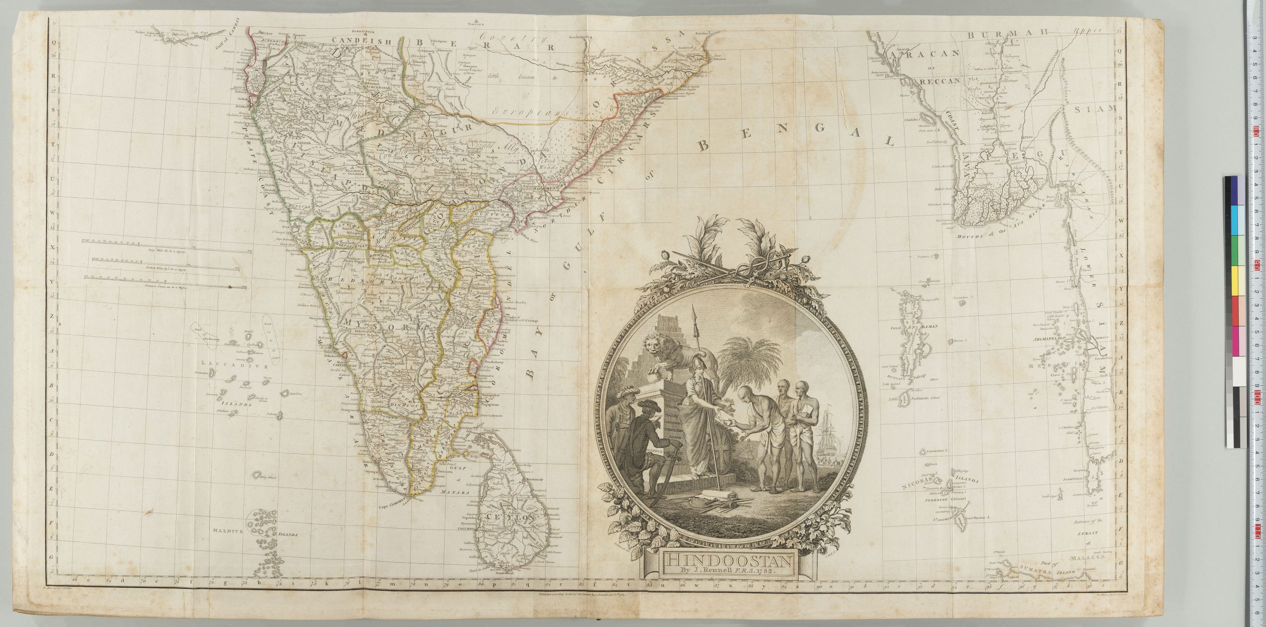
Memoir of a Map of Hindoostan, or, The Mogul Empire, James Rennell, 1793, London
James Rennell was a naval officer who served the British East India Company and a geographer known as the “Father of Oceanography.” For Britain, which was intensifying its colonial rule over India, then under the Mughal Empire and also known as Hindoostan, accurate maps were essential for both military and administrative purposes. As the first Surveyor General of Bengal, Rennell produced the first accurate map of India based on field surveys. After returning to Britain, he brought together these maps and reports with Indian documentary sources, including the Ain-i-Akbari, to produce this work, a comprehensive collection of maps and geographical information on India.
Advance Tickets
Museum Calendar
Museum
10:00a.m. - 5:00p.m. (Admission ends 30 minutes before closing time.)
Every Tuesday closed
Tel.03-3942-0280